Detail
Rougemont – Haute Combe (2039 M.a.s.l)
7,34 km
3:08 hrs.
1.007 m
85 m
87
TOP Moderate
Best season
JanFebMarAprMayJunJulAugSepOctNovDec
Download
Starting point of the tour
Rougemont (1007 M.a.s.l)
Destination of the tour
Haute Combe (2039 M.a.s.l)
Lowest point
998 m
Highest point
2.039 m

Properties
- Scenic
- Summit route
- Clear area
- Forest


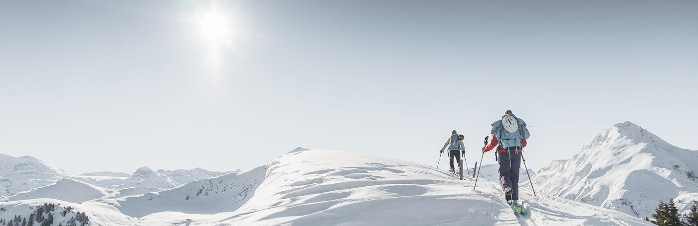
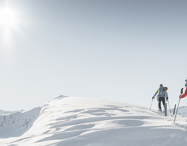
From Rougemont through the Vallée de la Manche and over the SW flank on the Haute Combe.
From Rougemont, follow the Route de la Croisette until you reach the forest. There you will reach the road that leads to the Vallée de la Manche. At the crossroads, turn right and follow the road until you are out of the forest. Then the route crosses the countryside via La Neirive and Raye du Baillif to Combette. Finally the ascent follows via the SW flank to the summit at 2039 m.a.s.l..
As a descent, the route via Col de la Forcla, Grands Craux and Le Pont back to Rougemont is recommended.
The ski route can be extended with the ascent to the panoramic summit Les Rodomonts and subsequent descent to Rougemont or Saanen.
Properties
Rougemont – La Forcla – La Manche – La Neirive – Combette – Haute Combe
Equipment
We recommend
- Ski touring equipment: touring ski-boots, touring skis with touring bindings, ski poles, skins, ski crampons
- Climbing harness
- Avalanche transeiver
- Backpack, shovel, probe
- Warm weatherproof clothing
- Warm gloves and warm hat
- Sunglasses and sunscreen
- Warm drinks
- Snack (high energy foods such as chocolate, dried fruit etc.)
Safety information
- Plan every mountain tour carefully and adapt to participants’ fitness level as well as the weather and season.
- Weather conditions can change quickly in the mountains. Appropriate clothing is therefore essential, along with adequate supplies of food and water. In uncertain weather, turn back in good time.
- Inform others of planned route, and whenever possible avoid going alone.
- It is forbidden to walk on the ski pistes.
- Please be considerate to other walkers and to plants and animals.
- Take note of the warning signs drawing attention to the constant danger in river beds and along watercourses below dams and reservoirs.
Public Transit
Rougemont, Train station
Parking
Parking Train Station Rougemont
Getting There
The Destination Gstaad is located in the south-west of Switzerland right on the border to the French-speaking part of the country. The Destination is easily accessed by rail or car from the regions around Lake Thun and Lake Geneva and the Gruyere region Direct connections to the European high-speed rail network and all international airports in Switzerland guarantee a time-saving and pleasant journey.
More information on gstaad.ch: Travel & Public Transport.
Additional Information
Further ski tours can be found under the following link:
https://www.gstaad.ch/en/winter/skiing-snowboarding/ski-tours.html
Map and arrival